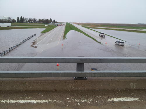
Update Mon. May 20, 2013 8:25 a.m. The NDDOT Reports that water has receded on both eastbound and westbound lanes of Intestate 94, west of Jamestown (mile marker 248). Motorists should be advised that conditions can change rapidly so motorists should use caution while traveling CSi Photos: 10:30AM Sunday by Brian Lang / CSi and 1PM Sunday by Thomas Ravely / CSi.
View Larger Map
The department also says there is the possibility of flash flooding on roadways in the northeastern part of the state over the next couple of days.
NDDOT encourages motorists to check road conditions before traveling. For updated road information, call 511 from any type of phone or go to the Travel Information Map on our website at www.dot.nd.gov.
Please be advised that road condition information on 511 and the travel map is updated daily from 5 a.m. until 9 p.m. CDT. The road report is based upon the information available to the NDDOT at the time of preparation and is provided solely as a public service. Conditions may vary from those reported.
The Bismarck National Weather Service reports that Jamestown received about 3.25 inches of rain and about 3.55 inches of rain fell 10 miles west of Jamestown over a two day period from Saturday into Sunday.
Valley City received about 1.05 inches of rain Saturday into Sunday.
Rain totals Saturday, Sunday, Monday and Tuesday is expected be released on Wednesday.
Reported Sunday May 19, 2013
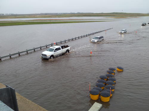
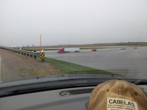
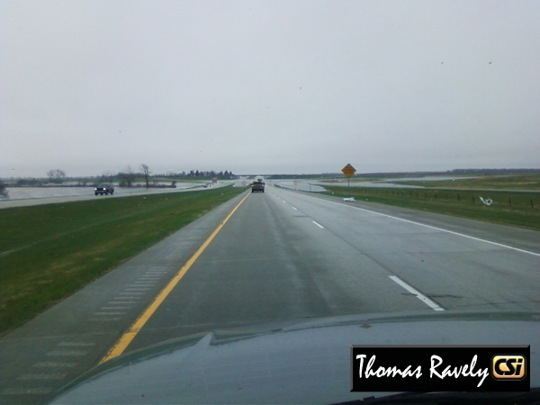
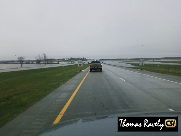
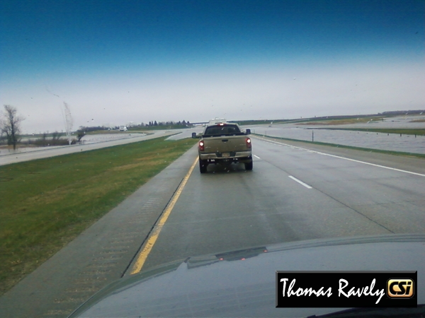
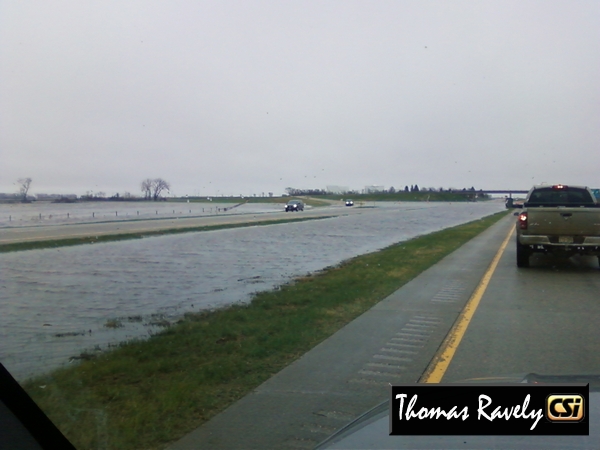
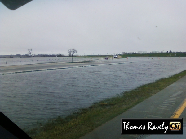
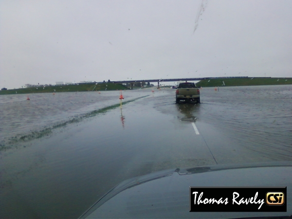
From NDHP Sgt. Rude May 19, 2013: Jamestown ND (KCSi-T.V. News) — On the evening of May 18th and norning hours of May 19th Stutsman County received rain and hail which has resulted in flooding on Interstate 94, mile marker 249 (10 miles west of Jamestown).
At approximately 5:30a.m. on May 19th two semis travelling westbound attempted to cross through the flooded portion of the roadway; however, each was swept off the roadway and into the median. Each semi remained there until a wrecker was able to get to them and pull them out, neither received any damage and both drove from the scene. During this time numerous eastbound semis and passenger vehicles became stranded in the flooded portion of the roadway as well where they remained for over an hour until waters receded enough to allow traffic to pass.
At last reort, westbound I-94 is closed at mile marker 249 and traffic is being detoured off at exit 248 (located at mile marker 249) then back down the westbound onramp which allows them to bypass the deepest portion of the flooding which is directly below that overpass. Prior to this detour traffic speeds are reduced to 35mph.
Sgt. Troy Hischer with the North Dakota Highway Patrol estimated the water is covering about 100 yards of the interstate.
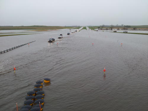
Hischer said at about 3 p.m. Sunday the water was starting to recede, but the Highway Patrol has no guess as to when normal traffic will resume.
Drivers are urged to slow down, watch for signs or flaggers and use caution because vehicles that leave the roadway may become immersed in water.
Eastbound I-94 has an electronic message board alerting traffic of the water hazard and speeds are reduced to 15mph. to allow vehicles to slowly negotiate single file through the flooded portion below the overpass. An eastbound detour route similar to westbound is not possible as the off ramp is under much more water. These waters are also causing damage to the road surface on portions of the flooded roadway.
Authorities also reported Sunday afternoon a car rolled over in the same area, as the driver was going too fast through the flooded roadway. No injuries reported.
The North Dakota Highway Patrol and North Dakota DOT are monitoring this situation and will continue to throughout the night.


Comments are closed
Sorry, but you cannot leave a comment for this post.