 Bismarck (CSi- Jan 27, 2017) The National Weather Service has issued an update to the 2017 spring flood outlook.
The Weather Service has been measuring moisture in the snowpack, and points out that a wet fall along with high winter snow pack has set the stage for near record runoff, in the Devil Lake Basin. Devils Lake and Stump Lakes could rise 3 to 4 feet above current levels this spring.
It shows that the Upper Sheyenne River Basin west of Cooperstown, this winter has been exceptionally wet and snowy.
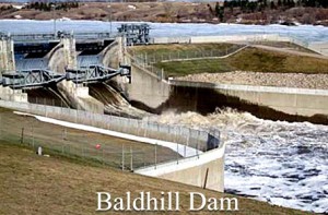
The area near Cooperstown into Baldhill Dam and Valley City proper is closer to normal for soil wetness and snow water content.
The fall of 2016 was the wettest over the entire Sheyenne River Valley since 2010-2011.
The 2017 threat is moderate to high for most river points but somewhat higher for eastern North Dakota tributaries.
Minor to moderate flooding is expected in most areas, with an increased risk for moderate to major flooding across east-central and northeast North Dakota.
The weather service says the remainder of the winter should continue to be cooler and snowier.
Temperatures from February thru April of 2017 is expected to have near to below average and precipitation near to above average.


Comments are closed
Sorry, but you cannot leave a comment for this post.